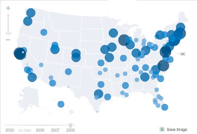
The Brookings Institute has posted a set of maps of United States states, principal cities, suburbs, and metropolitan areas with demographic data on population age, education, employment, and other criteria - all of this scrollable by time.
The top map above, for example, shows percent of the population over age 25 with Bachelor's degrees or above in metropolitan areas in 2008. The one below that shows percent of workers in each state who commute to work by driving alone.
Many hours of potential exploring here.


No comments:
Post a Comment